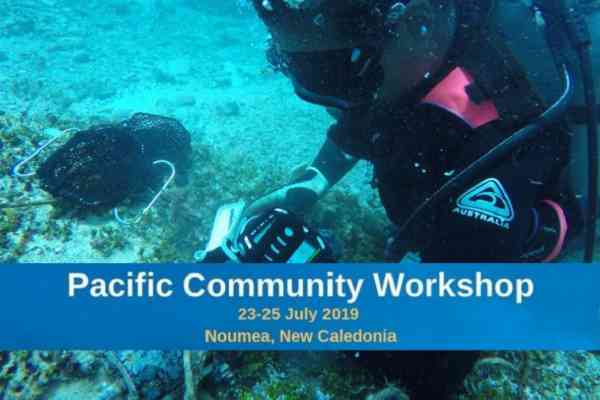

(disponible en anglais uniquement)
Ocean science plays an important role in mapping the region’s maritime boundaries says The Pacific Community (SPC) Deputy Director General
By Vishaal Kumar
Fiji Times
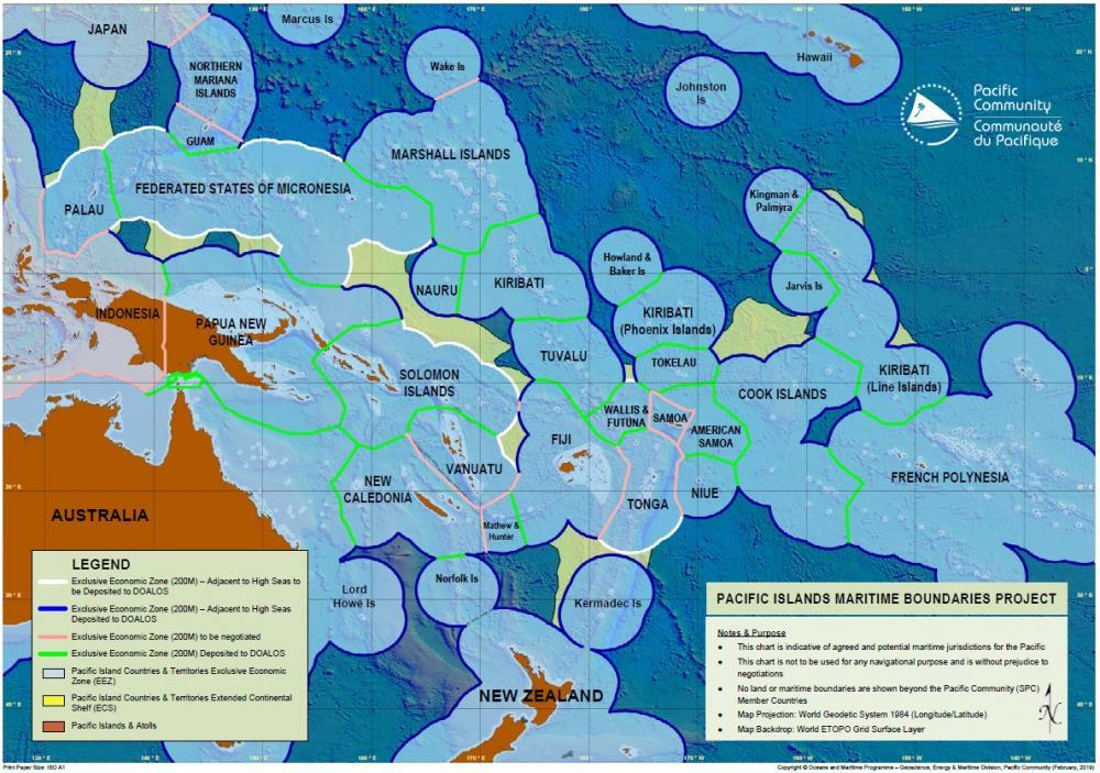
The baseline data of maritime mapping is essential to establishing maritime boundaries, according to The Pacific Community’s Deputy Director General, Cameron Diver, who says ocean science is instrumental to the entire process.
"You have to take into consideration if you are talking about straight baselines or if you need a different form of science to contribute to the knowledge that is the evidence based foundation for putting forward your baseline," Mr Diver said.
"Once you have established this, it is about knowing what is within your maritime zone so that you can preserve it where it is necessary and sustainably exploit that where possible.
"We can even look beyond the baselines today into areas beyond national jurisdiction,” he said.
It’s important to ensure that science contributes to evidence based decisions around the sustainable management of international waters to maintain biodiversity “which is the next frontier of ocean science” he said.
He added, there were challenges faced by countries in the region when it came to mapping out their maritime boundaries.
"There are huge drains on the capacity of smaller island states in terms of the requirements necessary to map boundaries," he said.
Once this was done, he said, there was also a need to police these boundaries and make sure people were not coming in and illegally accessing the resources that were within these boundaries.
He said science and technology could help contribute to the better management and policing of these maritime boundaries.
He also highlighted that SPC had a well established maritime boundaries program which had been in operational for a number of years and worked with a number of countries in the Pacific.
"We will continue to work and ensure all of our islands have their baselines and boundaries submitted in particular to the United Nations Convention on the Law of the Seas (UNCLOS) so that we can manage future impacts of climate change potentially on boundaries with sovereign rights that go with them," he said.
"We take into account what Pacific island countries are asking us about, which is to help ensure for the future their sovereignty over the resources and water columns that makes up the exclusive economic zones (EEZ's) and territorial seas of large ocean states."
You're able to enjoy independent news coverage like the above through SPC’s Australian funded Climate and Ocean Support Program in the Pacific (COSPPac).