(Article disponible en anglais uniquement)
Good data is at the heart of planning for and responding to natural disasters in the Pacific. The region has invested heavily in tools to monitor changes in the environment, and be better prepared for the extreme conditions that can threaten Island nations.
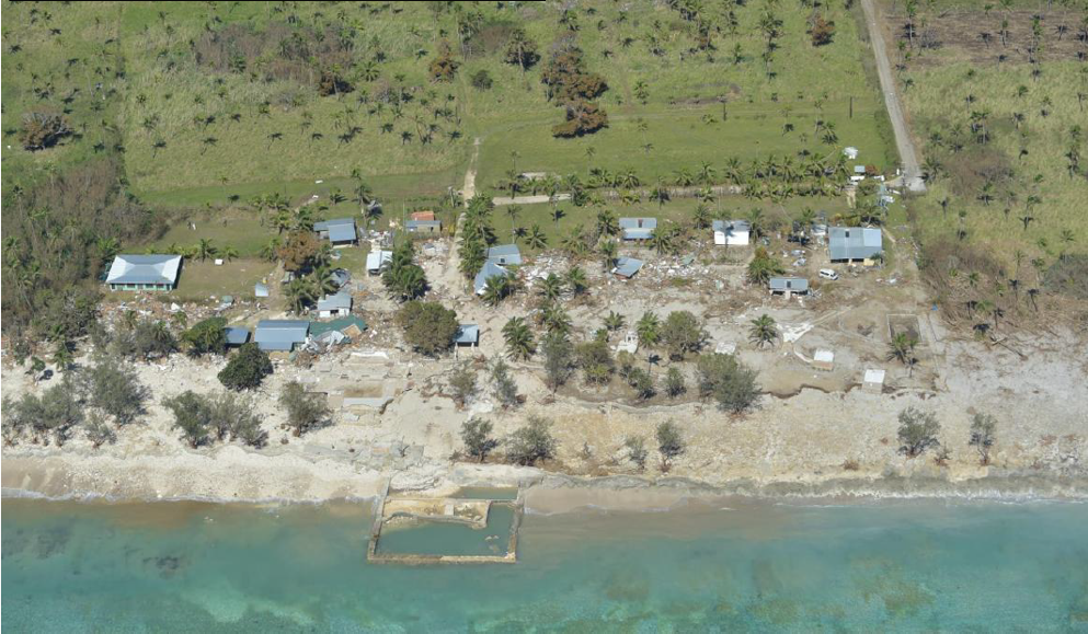
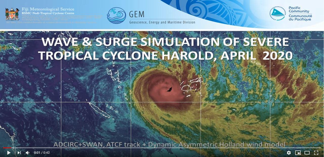
Tropical Cyclone Harold provided a good opportunity to put some of those tools to use. The wind, waves and water levels during this storm have been simulated into a high-resolution model to show how waves impacted Pacific coastlines during the disaster. The data obtained from this model can now help inform future disaster response and planning.
Pacific Community (SPC) Team Leader, Oceanography, Mr. Herve Damlamian, explained how such models are invaluable to his work. “They provide detailed insights on the range of wave height and storm surge experienced along the coastlines of Vanuatu, Fiji, and Tonga. Correlating this with on-the-ground impact surveys helps us connect the dots between the range of hazard intensity experienced on the coastal zone and its related impacts on buildings and key island infrastructure such as power plants, roads, etc.. Overall such a model supports our increased regional risk knowledge.”
The animation shows the reconstruction of TC Harold's winds, storm tide (a combination of storm surge and tide) and waves based on the best track data produced by the Fiji Meteorological Service. From the 02 to 10 April, TC Harold coincided with king high tides in some locations along its track, resulting in catastrophic damage in Vanuatu, Fiji and Tonga.
Apart from the gale force winds associated with Tropical Cyclones, major damage in coastal areas is produced by high water levels at the shoreline. This coastal flooding or inundation is due to the interaction of storm surge, tides, and the action of extremely high waves.
The high-resolution model was shared recently as part of a presentation by the Tonga Meteorological Services to the National Emergency Management Committee, reporting on the end of the Tropical Cyclone season for 2019/20.
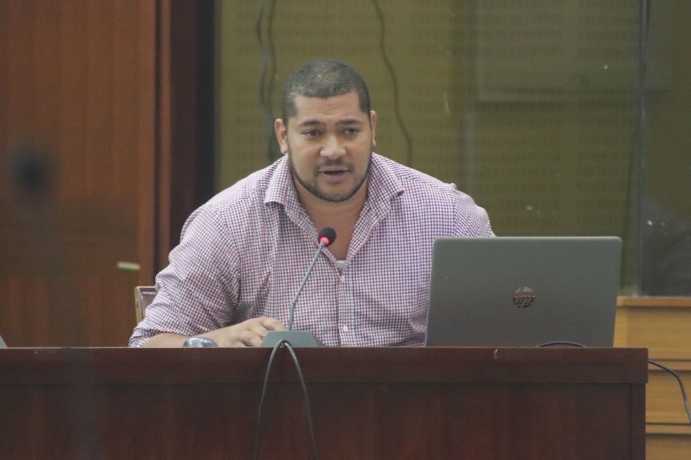
In his presentation to the committee, Deputy Met Director, Mr. Laitia Fifita reported that, “The SPC model demonstrated to stakeholders the application and importance of real time data in terms of Early Warning to show the intensity of wave height and storm surge during a natural disaster.”
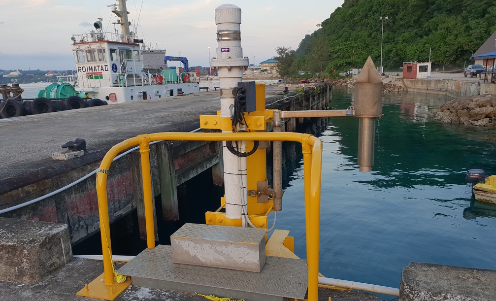
The state-of-the-art numerical model which accounts for the influence of sea mounts and other ocean floor features, was developed by SPC Oceanographer, Dr. Antonio Espejo. The high performance of the model was validated by comparing the results against known measurements of sea level and waves from tide gauges and wave buoys.
SPC’s Acting Deputy Director Oceans and Maritime Programme, Mr Jens Kruger is confident in the investment being made in these systems.“The good agreement between model results and measurements provides technicians, stakeholders and community members with the confidence that such technology could be further explored to strengthen Tropical Cyclone driven risk and forecast information.”
He adds, “This modelling work demonstrates the continuous effort that SPC is doing to advance cutting-edge technological approaches the Pacific, strengthening our knowledge about extreme events and our capacities to make more resilient communities.”
For more information, contact:
Merana Kitione ([email protected])
Capacity Development and Communications Officer, GEM