The Pacific Data Hub (PDH), an initiative of the Pacific Community (SPC), is a response to the lack of reliable, timely and easily accessible data in the Pacific region, which is particularly challenging in times of crisis and natural disasters. The PDH platform makes it easier to find information, and will help improve data management and enhance governance practices through informed decision making.
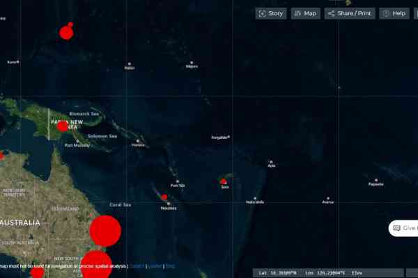
PacificMap is a feature of the platform that provides map-based spatial data from the 22 Pacific Island countries and territories (PICTs). Access to this timely, relevant and valuable spatial data will benefit government and non-government organisations, businesses and communities throughout the Pacific.
Another feature of the platform is a collection of country and regional data that highlight the economic vulnerability of PICTs to disasters and external shocks.
In times of crisis, access to spatial data can facilitate rapid response by identifying where to send rescue and relief teams.
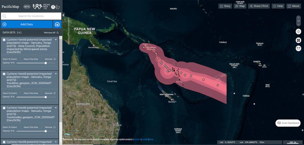
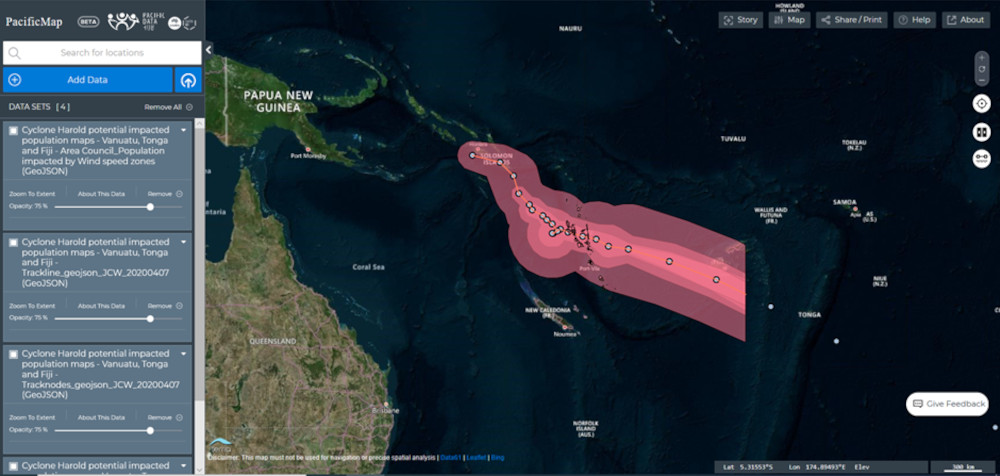
Two major events in 2020 that have resulted in significant social, economic and infrastructural disruption – Tropical Cyclone (TC) Harold and the Coronavirus (COVID-19) pandemic – have already demonstrated the value of a centralised resource for high-quality spatial data and information.
Following TC Harold and the emergence of COVID-19, the PDH PacificMap tool was used to visualize inputs from different technical divisions of SPC. This data helped SPC to effectively orient the delivery of international development assistance by offering key information about the affected areas and populations.
These maps have also assisted PICTs with decision making around the pandemic by providing population density data. The population grids that can be found on PacificMap (https://map.pacificdata.org/ ) have been generated for PICTs to provide population densities for COVID-19 response planning purposes. The grids cells are 100 m x 100 m (1 hectare) and are modelled using the most recent census data, projected where possible to 2020.

PacificMaps, as well as many other features of the Pacifc Data Hub is still in beta. The team continues to work every day to improve it, thanks to user feedback and lessons learned. SPC hopes that, once operational, PacificMaps becomes an essential tool for responding to current and future crises in the Pacific.