(disponible en anglais uniquement)

For Pacific island countries and territories, maritime boundaries are national borders. A State’s maritime boundary can lie adjacent to the high seas, or be shared with another country.
The UN Convention on the Law of the Sea (UNCLOS) is the international agreement that establishes all coastal States’ rights to a marine jurisdiction. Under UNCLOS, all coastal States are entitled to a territorial sea, extending 12 nautical miles (~22 km) from the baseline, which is generally the coastline. They are also entitled to a contiguous zone extending 24 nautical miles (~45 km) from the baseline, an EEZ extending to 200 nautical miles (~370 km) from the baseline. Some coastal States may also be entitled to an extended continental shelf or archipelagic waters. Where countries’ entitlements to maritime zones overlap, they need to negotiate a shared boundary.
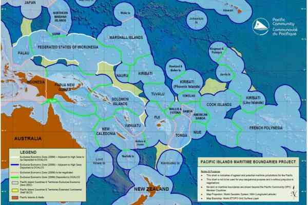
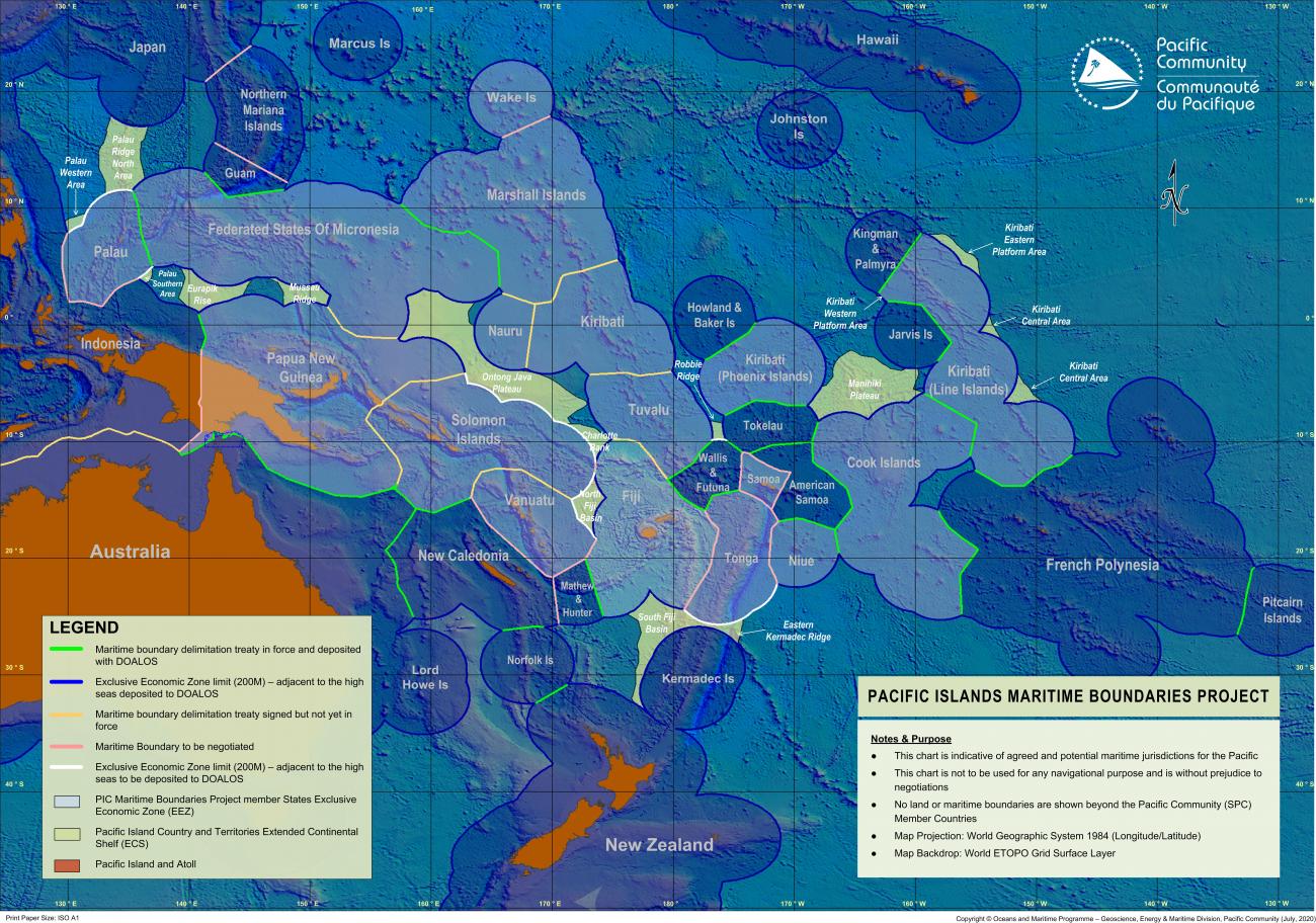
There are 48 shared or overlapping boundaries between countries in the Pacific Islands region. As of July 2020, 35 of these boundaries have been formalised, and there are 13 outstanding bilateral and five high seas boundaries remaining to be declared. Out of the 17 existing extended continental shelf submissions, one was recommended in 2019.
The above map illustrates the status of Pacific Maritime Boundaries as of July 2020.