Mapping our Pacific Geospatial Future
Imagine a world without maps. It’s hard to do. Humans are born map-makers, instinctively looking for landmarks, making sense of patterns, and forming connections when we venture beyond our known environment.
For this reason, geospatial science may be one of the most important fields of study you have ever heard of. Geospatial information is location information. At its simplest, this can be topographical information found on a map. But you can also add in layers of location-tagged data, to show changes or trends, for example, in land use, population density, vaccine distribution, or coral reef health over time.
“If you look at Fiji’s national development plan, there are so many areas where geospatial information comes in. There are calls for hazard maps, for strengthening land administration,” says Ms Meizyanne Hicks, Fiji’s Director, Geospatial and vice-chair of the Pacific Geospatial and Surveying Council. “In this way, the Integrated Geospatial Information Framework (IGIF) supports the implementation of Fiji’s national development plan.”
What is the IGIF?
Meizyanne Hicks and her team have been a driving force in putting the IGIF into practice in Fiji in recent years. The IGIF is a tool to examine and strengthen national geospatial information management to support sustainable development.
Essentially, it is a step-by-step process that helps teams working on disparate geospatial initiatives around the country link up, identify common goals and challenges, and take steps to integrate their activities. It has been endorsed by the United Nations Committee of Experts on Global Geospatial Information Management (UN-GGIM) and Fiji was one of six pilot countries identified for support in rolling out the processes outlined in the framework.
This process started in 2019 and to some extent, progress on the IGIF slowed during the pandemic, with limited travel, gatherings, and challenges inherent in remote meetings. However, in Fiji, the development of the COVID-19 dashboard also served as an example of the value of cross-sectoral geospatial collaboration.
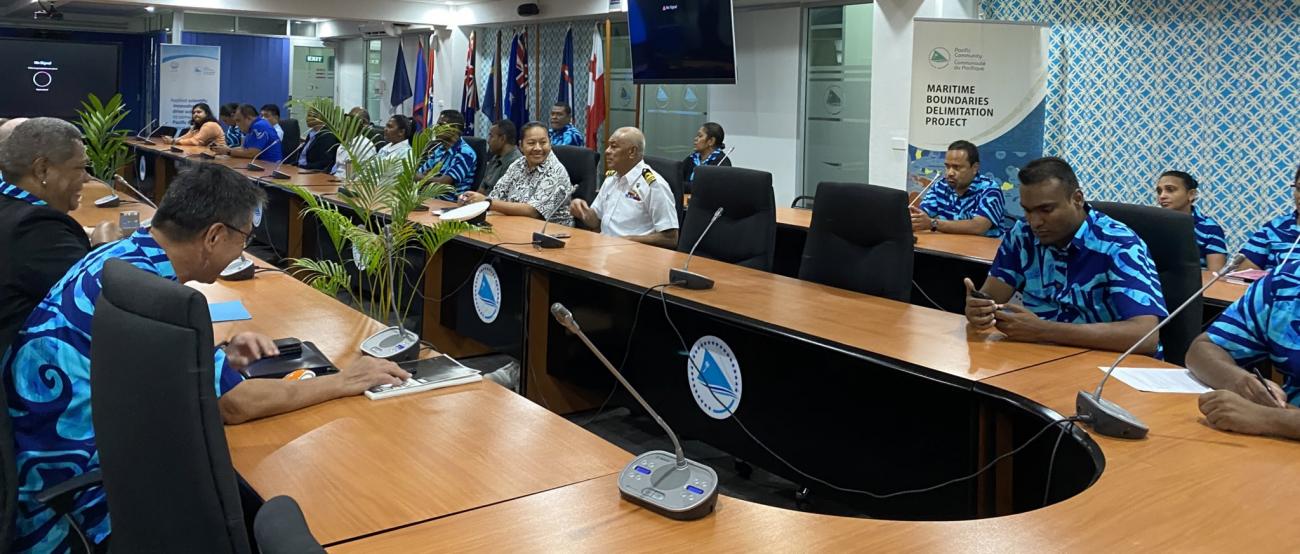
As the country starts recovering from the pandemic, more than 80 geospatial users from all over Fiji have met this week as part of a national consultation to explore how geospatial information is currently used and managed and how this could be improved in the future. With support from UN-GGIM experts and the Pacific Community (SPC), this consultation is helping to identify opportunities to strengthen Fiji’s location-based policies, infrastructure, standards, human resources, and much more.
“The pandemic has shown us that we cannot continue to work in silos, we need to work together. This geospatial framework will help make that possible,” said the Permanent Secretary for the Ministry of Lands and Mineral Resources, Ms Raijeli Taga at the opening of the workshop.
Country-Owned, Country-Led
“This process is first and foremost country-owned and country-led,” emphasises UN-GGIM Secretariat Chee Hai Teo, who joins the team in Fiji this week to support the consultations. “We don’t fly in consultants to write the action plan- there is so much to be gained when countries do this themselves.”
Teo has been providing guidance to six countries to undertake this work over the last few years: Burkina Faso, Ethiopia, Nepal, Mongolia, and, in the Pacific, Fiji and Tonga. He is encouraged by the steady progress that has been made in these countries and the enthusiasm he has seem blossom as countries have taken ownership of the process to develop and implement their own action plans.
“We started this process in 2019,” said Ms Halalilika Etika, Tonga’s Deputy CEO Geospatial, for Tonga’s Ministry of Lands. “We conducted consultations, circulated questionnaires, and identified gaps in our geospatial information. Especially when it came to climate change and disasters, we found a lot.”
“Some people think we're giving the countries lots of resources, but in fact, what these pilot countries have been doing is giving a lot to the world,” says Teo. “They are using the framework and validating what is useful or not useful and helping to tweak the approach.”
Lessons for the Region
Following Fiji’s national consultations, the Pacific Geospatial and Surveying Council, in partnership with UN-GGIM and SPC, hosted a two-day learning event on 16-17 June. The purpose of this workshop was to share experiences from Fiji and Tonga, and to get other regional geospatial leads thinking about steps they could take to make similar progress.
The Pacific Geospatial and Surveying Council (PGSC) is the region’s homegrown advisory body on geospatial and surveying issues and serves as a forum to address Pacific challenges and strategize future developments.
Geospatial and location information underpins the majority of economic and development activities in the world today, and the Pacific is no exception.
“In the face of climate change, accurate geospatial information is more important than ever in understanding risks to critical infrastructure and planning for the future,” said PGSC Chair and CEO of Tonga’s Ministry of Lands and Natural Resources, Ms Rosamond Bing.
“One of the big challenges we have faced is the ability to communicate what we need to decision-makers and stakeholders. This journey of developing the action plan has helped us to communicate on geospatial information,” noted Tonga Ministry of Lands and Natural Resources Deputy CEO, Mr Viliami Folau.
Ms Hicks agreed. “Once our stakeholders saw what geospatial information could do for them, they were more supportive of developments,” she said during the workshop. “But we needed to show them that to get reliable timely information at the click of the button requires significant investment.”
This year marks the halfway point of the Pacific Geospatial and Surveying Council’s 10-year strategy, and even in the face of pandemic setbacks, there is significant progress to celebrate.
SPC’s Director General, Dr. Stuart Minchin, congratulated Tonga and Fiji on their respective progress toward developing and operationalising national action plans for geospatial information management.
“This is a challenging undertaking, but one with many benefits for the national bodies and agencies leading it,” said Minchin.
Minchin also noted that this critical work would help lay the foundation for further geospatial development throughout the region. “We recognise the economic and social benefits of robust geospatial and surveying services, particularly in a post-COVID Pacific, focused on economic recovery and resilience.”
For more information:
Merana Kitione, Capacity Development & Communications Officer, Geoscience Energy & Maritime Division, Pacific Community (SPC) | [email protected]
About SPC:
The Pacific Community has been supporting sustainable development in the Pacific, through science, knowledge and innovation since 1947. It is the principal intergovernmental organisation in the region, owned and governed by its 27 member countries and territories. www.spc.int
Follow SPC News | Facebook | Twitter | LinkedIn | Instagram | YouTube
About PGSC:
The Pacific Geospatial and Surveying Council (PGSC) is an independent regional advisory body that provides a forum for Pacific Island geospatial information and survey authorities to discuss and address regional challenges. SPC hosts the Partnership Desk for the PGSC. Website | Facebook