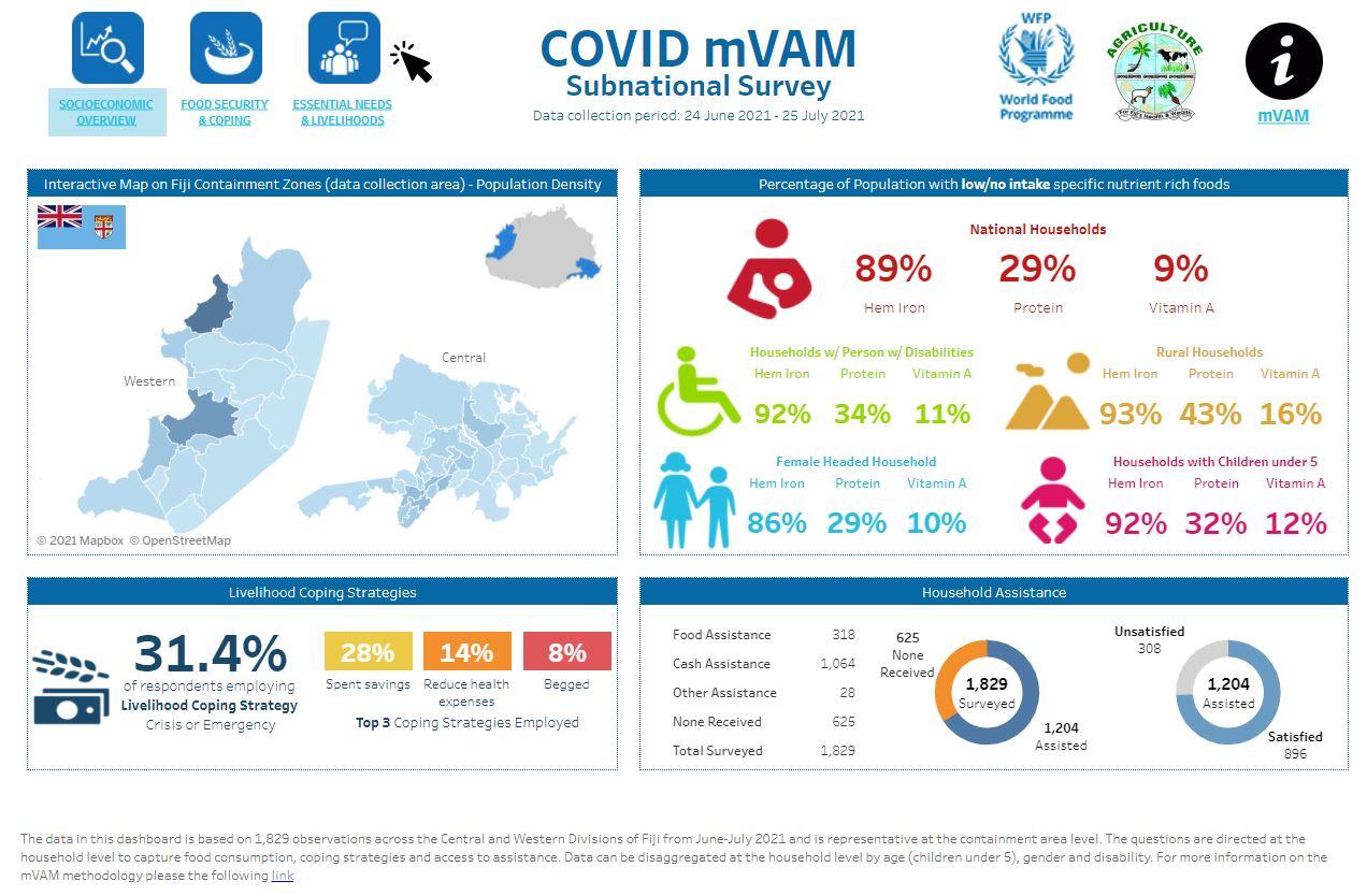
Photo: Latest dashboard from COVID-19 mVAM Survey of Containment Areas in Fiji (August 2021) - WFP
Pour prendre des décisions en période de crise, notamment dans le contexte actuel de pandémie de COVID-19 et de changement climatique en Océanie, il est essentiel de disposer d’un accès rapide à des données fiables concernant la sécurité alimentaire. Les services nationaux d’intervention en cas de catastrophe ainsi que les organismes qui les assistent doivent absolument pouvoir accéder à des données actualisées sur ce sujet.
(contenu complet disponible en anglais uniquement)
Mobile Vulnerability Analysis and Mapping of Food Systems: Supporting Access to Timely and Open Data in the Pacific
Timely access to reliable data on food security is vital for decision making in times of crisis, especially for the Pacific in the context of the current COVID-19 pandemic and climate change. There is an ongoing pressing need for timely data on food security to be readily accessible to national disaster responders and the agencies supporting them.
Open data is a key principle that guides the work of the Vulnerability Analysis and Mapping (VAM) technical unit at the World Food Program. VAM collects data related to food systems with the objective of making this information as accessible and transparent as possible.
mVAM data collection
In 2020, the WFP Pacific Multi Country Office (MCO) deployed mobile Vulnerability Analysis and Mapping (mVAM), to regularly collect data in Fiji, Samoa, Tonga, Vanuatu, and Kiribati.
Data on the effects of COVID-19 and climate shocks on household food security was collected through mVAM using mobile phone surveys and live telephone interviews. Indicators such as Food Consumption, which is a way to understand the quantity and quality of a household’s diet, livelihood coping strategies and basic elements relevant to nutrition which serve as a proxy indicator, were collected. The data collected against these indicators was then processed and analyzed to understand the risk of food insecurity to the population of concern.
The initiative supports safe remote data collection that can be disaggregated by age, gender and disability at the household level and provides high-frequency and operationally relevant data to key stakeholders including government. It also supports accountability to affected populations through automated two-way communication that provides respondents and the public access to near real-time information through online dashboards.
Remote data collection
Ensuring key stakeholders have access to timely information on the impacts of shocks on the food security situation of vulnerable populations is of increased importance during COVID-19 and in responding to shocks in general, especially in areas with limited access. Remote data collection is a timely, flexible, and efficient way to collect this information.
How mVAM data is used
In the Pacific the mVAM approach has enabled WFP and government partners to track the situation regionwide over time and understand any increased food security vulnerabilities as a result of the COVID-19 pandemic.
Regular dialogues with national Food Security clusters helped inform contextualizing the mVAM approach for the countries where it has been launched. Regular briefings on mVAM results are also provided through the Regional Pacific Food Security Cluster which includes representatives from national clusters, regional organizations including the Pacific Community (SPC) and University of the South Pacific (USP), UN agencies, donors, NGOs, and civil society.
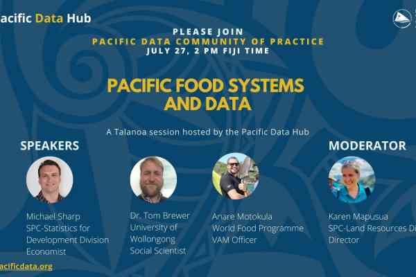
In July 2021 WFP participated in the Pacific Data Hub Community of Practice talanoa on Food Systems data. Anare Motokula, VAM and GIS officer, presented on the mVAM initiative and the importance of seeking opportunities to build partnerships and collaborate with key regional and national stakeholders on utilizing open data. Leveraging the Pacific Data Hub as a central data repository, WFP shares information on the mVAM initiative as well as other reports with the objective that governments and partner agencies from the region can more readily access this data.
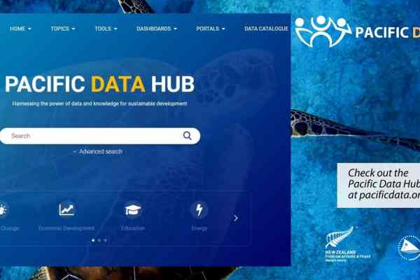
Pacific Data Hub
The Pacific Data Hub provides a regional database that aligns closely with WFPs principles and policies, through improving data accessibility and maintaining respect for key data protection and privacy principles.
With the current COVID-19 health risks and travel restrictions, mVAM’s timely insights into the effects of COVID-19 on food security has come at an important time. This enables governments to use the mVAM data to understand the effects of COVID-19 on food security. In Fiji, through the government led COVID-19 data working group, mVAM has been adapted and deployed to monitor the effects of containment measures on food security, livelihoods, and access to assistance across the Central and Western divisions. The findings will be used to inform strategic advocacy and decision making related to current and planned future food security and assistance interventions.
Download
mVAM dashboard links for Fiji, Kiribati, Samoa, Tonga and Vanautu can be found here.
Contact
Please contact Anare Motokula ([email protected]) or Wendy Alvarado Alvarado ([email protected] ) for further information on mVAM.