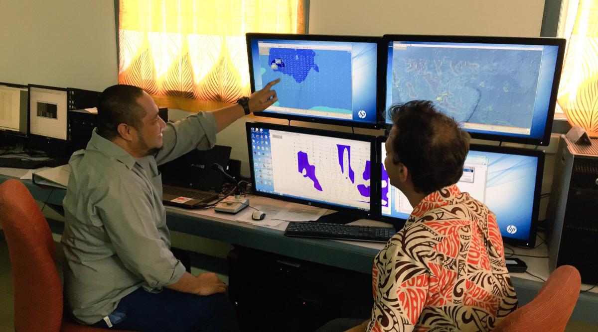
Models used by forecasters at Tonga Meteorological Service rely on accurate positioning satellite data
Understanding where we are and where things are in relation to us has always been important.
Anyone who has ever used a smartphone app to locate themselves or search for driving directions can appreciate how widespread this technology has become, to the point that it is even taken for granted. ‘Where’ is now at everyone’s fingertips.
On Earth’s dynamic surface, however, ‘where’ we are is constantly changing.
We understand this through Geodesy, the scientific discipline that enables us to define the shape of Earth, how it changes over time, and our position on Earth. Such positioning information is needed to analyse and solve social, economic and environmental challenges and to support sustainable development.
The United Nations acknowledged the importance of ‘where’ in 2015 when the United Nations General Assembly adopted the resolution entitled ‘A Global Geodetic Reference Frame for Sustainable Development’. It provides a mandate for countries to improve geodetic infrastructure necessary to support science and society.
The Global Geodetic Reference Frame (GGRF) or the ‘global grid,’ is the framework that allows us to precisely determine and express locations on the Earth, as well as to quantify changes of the Earth in space and time. Most areas of science and society at large depend on being able to determine positions with a high level of precision.
The importance of ‘where’ in the Pacific
The work of Pacific Island geospatial scientists and surveyors helps improve the security and well-being of Pacific people. It supports understanding of our roads and transport, ports and shipping, water and sewerage, energy and power utilities, telecommunications, construction, agriculture, town planning, climate change adaptation and many more sectors and industries. All of these are critical to ensure we can develop resilient communities and countries into the future.
To further develop the region’s capabilities and share lessons, surveyors and geospatial experts from 14 Pacific Island Countries have formed a community of practice, called the Pacific Geospatial and Surveying Council (PGSC). In 2014, the PGSC adopted a charter governing its role and responsibilities, which has been endorsed by 11 Pacific Island governments to date.
The vision of the PGSC is:
Sustainable development in the Pacific enabled by world-class geospatial information and surveying services.
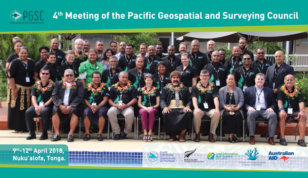
At their 4th meeting in April 2018, the PGSC launched a 10-year strategy outlining the priorities and needs for the continued development of geospatial and surveying capacity in the region.
One of the four main goals of the PGSC strategy is that countries across the region adopt a modern Geodetic Reference Frame (GRF) underpinning fundamental geospatial systems and applications.
Most of the reference frames used in the Pacific Islands are out-dated and not aligned with the global standard. In other words, individual country maps are isolated and are not connected to the global grid. In some cases, this might mean that reefs, submerged vessels and other landmarks on an international navigational chart could be off from the local chart by 10 meters or more.
Pacific Island countries want to transition to a modern geodetic reference frame, aligned with the Global Navigation Satellite System (GNSS)- a network of more than 120 positioning satellites that orbit the Earth. Data capture using GNSS is precise, efficient and increasingly cost effective. These factors are key to informed decision-making.
New facility in Tonga contributes to informed decision-making
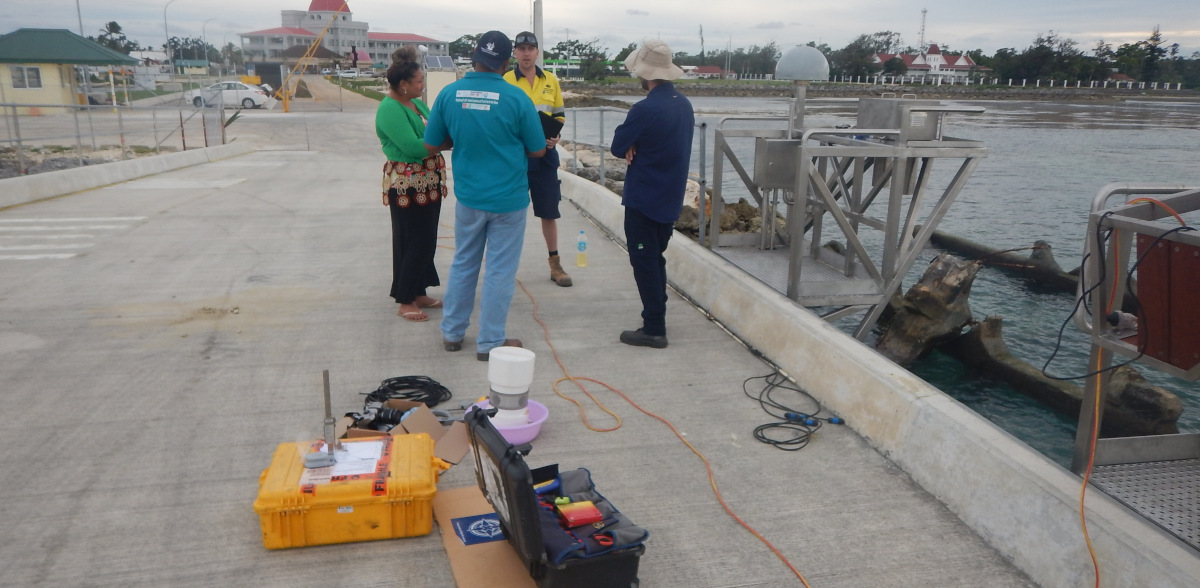
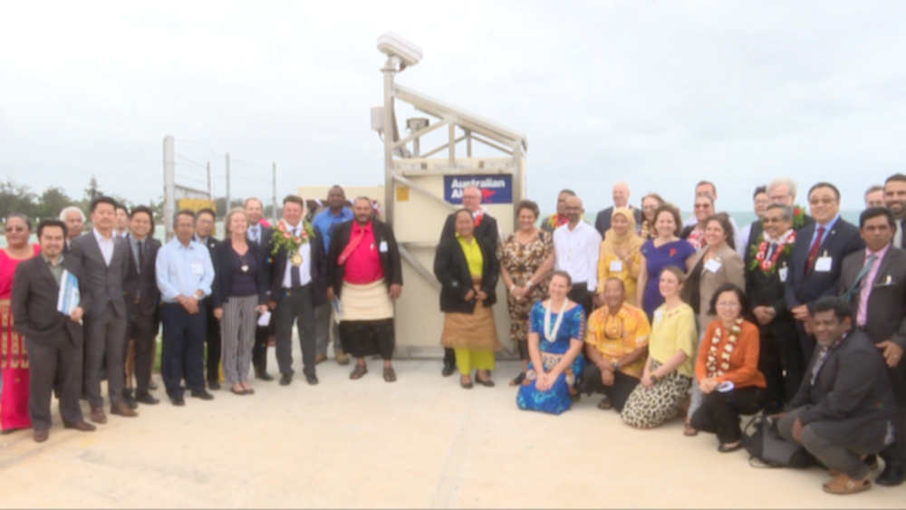
A new sea level and geodetic monitoring station was installed on Vuna Wharf and recently commissioned by the Honourable Prime Minister of Tonga, Samiuela ‘Akilisi Pohiva, with support from the Australian Government.
The station provides high quality tide, sea level, and climate information to support better coastal planning and preparedness.
It features the most advanced monitoring technology available, including three separate sensors to measure the sea level. The station also includes a GNSS Continuously Operating Reference Station (CORS) that measures vertical and horizontal land movement, enabling determination of absolute sea level. It is only the second COR Station established in Tonga.
“We are so very grateful for the real-time environmental intelligence that the new tide gauge and earth-monitoring station brings to Tonga,” said the Hon Prime Minister during the commissioning ceremony. “The data gathered and shared via these systems will continue to make a difference in the years ahead to our communities, businesses and government initiatives.”
Partnerships to achieve goals
The PGSC cannot hope to achieve its goals without a little help from its friends. Fortunately, PGSC member countries have established technical partnerships with numerous international and regional agencies. One example of such partnership is Geoscience Australia (GA), who have supported Pacific Island geospatial and surveying colleagues for many years and have been involved in the PGSC since day one.
In July 2018, two surveyors from the Kingdom of Tonga- Mr. Viliami Folau and Ms. Siotasia Malolo- undertook a two-week work placement at Geoscience Australia with support from the Pacific Community (SPC). During this placement, the team were able to draft a strategy to modernize Tonga’s Geodetic Reference Frame.
Ms. Siotasia Malolo reflects on her work placement and its significance to Tonga:
“The placement with GA was amazing and a good experience. I’ve learned so much and I believe that I am now more confident in carrying out my duties as a surveyor. Basically, we were looking forward to gaining more in depth knowledge on, Geodetic Network Design and maintenance plan, the process for developing a Modern Vertical Reference Frame and a National Height System.
“The outcome of the placement was pretty awesome because with the help of Nick Brown, Ryan and Josh, we were able to come up with a Geodetic Strategic Plan for the whole of Tonga.
“The modernizing of Tonga’s geodetic reference frame will be a big milestone for Tonga. It will take Tonga to a whole new level in terms of positioning. Knowing where you are is very important. Though this will take years for it to be implemented, I’m happy that we are taking it one step at a time.”
Where to from here?
The Kingdom of Tonga, with assistance from Geoscience Australia, have not only adopted the strategic objectives of the UN General Resolution and goals of the PGSC strategy, but have also developed an implementation plan and a set of actions to realise the strategic objectives.
The implementation plan includes actions to deliver:
- Modern geodetic reference frame aligned to the International Terrestrial Reference Frame 2014 (ITRF2014; a type of global geodetic reference frame)
- Modern height reference frame based on a geoid model; and
- Land and Survey Act which utilises actions (1) and (2).
In the coming years, staff from the Ministry of Lands will be collaborating with other Ministries within the Tongan government, PGSC, United Nations Global Geospatial Information Management Asia Pacific (UN-GGIM-AP), Geoscience Australia and other regional partners to carry out this action plan and ensure Tongans are well equipped to take advantage of the power of ‘where’.
This work was made possible with support from the Australian-funded Climate and Ocean Support Program in the Pacific (COSPPac), the International Federation of Surveyors (FIG), the United Nations Committee of Experts on Global Geospatial Information Management (UN-GGIM) and a growing number of international partners.
For more information:
Evlyn Mani, PGSC Partnership Desk, SPC [email protected]
Molly Powers-Tora, PGSC Partnership Desk, SPC [email protected]
Nicholas Brown, National Geodesy Section Leader, GA [email protected]