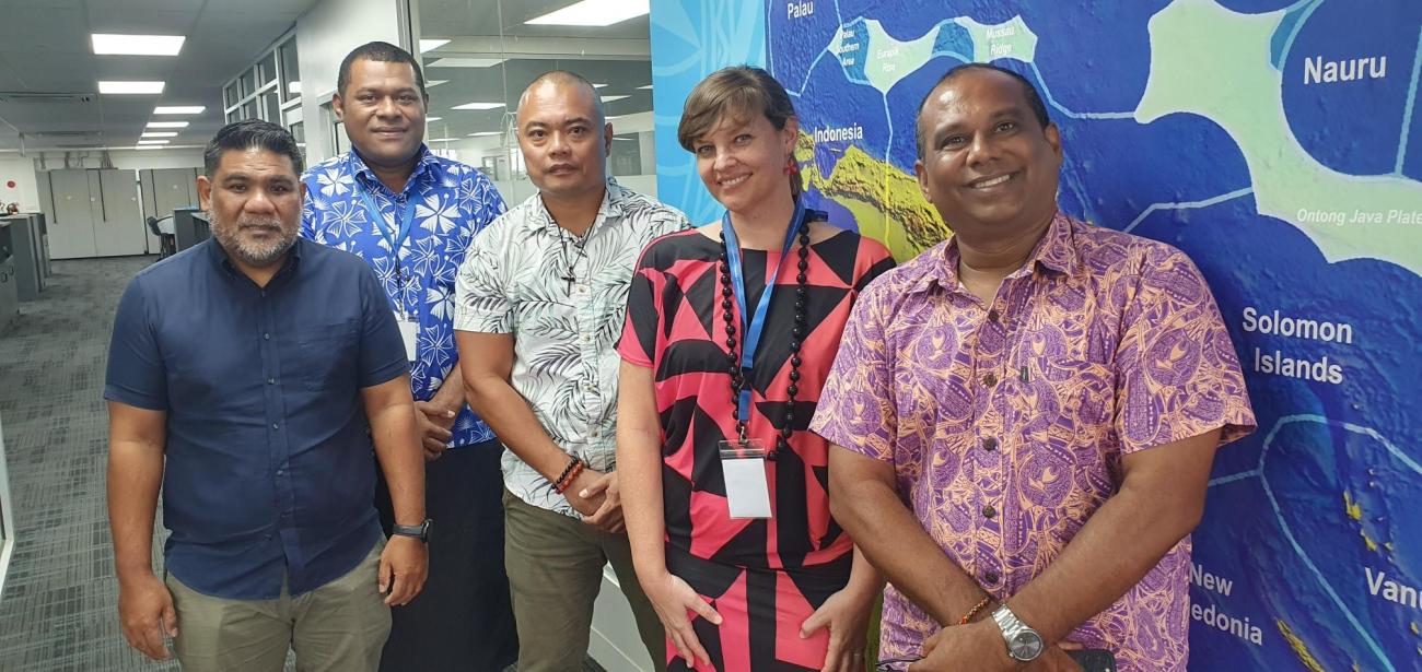
Palau officials, Mr David Idip and Mr Takamatsu Emesiochel of PALARIS with Malakai Vakautawale, Molly Powers-Tora, and Andrick Lal of SPC
At the 2022 Our Ocean Conference, His Excellency Surangel Whipps Jr., President of Palau, officially launched an initiative to develop a marine spatial planning process to guide the sustainable management of Palau’s exclusive economic zone (EEZ).
In support of this effort, Palau is progressing an ambitious programme to define its maritime boundaries, limits and zones, including the outer limits of its extended Continental Shelf (eCS).
Across the Pacific, the importance of establishing maritime boundaries and zones is increasingly recognised as an essential precondition for the sustainable management of ocean and seabed resources.
Under the United Nations Convention on the Law of the Sea (UNCLOS), all coastal States’ have the right to establish a marine jurisdiction, including a 200 nautical mile exclusive economic zone (EEZ) and, if certain criteria are met, exclusive rights to the seabed of the continental shelf extending beyond the EEZ.
Establishing rights over ocean space in accordance with international law is crucial for the livelihoods of generations of Palauans to come. In fact, until these gaps in the Blue Pacific map are closed, coastal States may not be able to fully protect their interests or move forward with their national development plans.
The SPC Maritime Boundary team supports Pacific Island Countries and Territories to establish their maritime zones with technical mapping, legal drafting, and diplomatic advocacy support. In April 2023, through the Pacific-European Union Marine Partnership (PEUMP) programme, SPC hosted a training with two officials from the Land and Resource Information System Office (PALARIS), Palau’s national geospatial office. The one-week professional attachment provided an opportunity to review the country’s maritime boundaries and complete related technical activities, including finalizing territorial sea baselines.

Palau officials, Mr David Idip and Mr Takamatsu Emesiochel of PALARIS with Malakai Vakautawale, Molly Powers-Tora, and Andrick Lal of SPC
In addition, the team successfully completed and verified the schedule of EEZ coordinates and drafted charts of the country which will go for legislative review to become part of national law.
“SPC has been providing technical support throughout the years to support the work on maritime boundaries. Human resources are limited in Pacific countries and this time here helped us to focus on the topic and to ask questions directly to the experts,” said David Koro Idip Jr., PALARIS Senior GIS analyst.
The training also included a peer-to-peer learning session with Fiji’s Geospatial team on Vanua View, the geographic information system (GIS) based platform which Fiji uses to manage national geospatial data. Palau hopes to implement a similar system to strengthen their management of land and ocean areas.

Fiji Director Geospatial, Ms Meizyanne Hicks, and her team introduce PALARIS officials to the Vanua View spatial data management system
This activity was funded by the European Union and the government of Sweden, through the Pacific-European Union Marine Partnership (PEUMP) programme.
Delivery of the activities is supported by the Pacific Maritime Boundaries Consortium of partners including the Pacific Community (SPC), the Pacific Islands Forum Secretariat (PIFS), the Forum Fisheries Agency (FFA), the Office of the Pacific Ocean Commissioner (OPOC), GRID Arendal, the University of Sydney, the Commonwealth Secretariat, and the Governments of Australia, New Zealand, the United Kingdom, and the United States of America.
About:
 The Pacific-European Union Marine Partnership (PEUMP) Programme addresses some of the most serious challenges faced by Pacific countries. Among these are the increasing depletion of coastal fisheries resources; the threats to marine biodiversity, including negative impacts of climate change and disasters; the uneven contribution of oceanic fisheries to national economic development; the need for improved education and training; and the need to mainstream a rights-based approach and to promote greater recognition of gender issues to ensure inclusiveness and positive changes for Pacific island people. The seven-year PEUMP programme is funded by the European Union (EUR 35 million) and the government of Sweden (EUR 10 million). It is implemented by the Pacific Community (SPC), the Forum Fisheries Agency (FFA), the Secretariat of the Pacific Regional Environment Programme (SPREP) and the University of the South Pacific (USP) in close collaboration with Non-Government Organisations and the national authorities.